


Hometown History Homework #6: The New York / New Jersey Line Dispute
It’s time to talk about boundaries

State boundaries can be wonky. Especially here in the Northeast, where state boundaries were once colonial boundaries that merely emerged from natural and geographic outlines, like rivers and oceans. That’s the case for three out of four of New Jersey’s trapezoidal sides. The state is bordered by the Atlantic Ocean on the east, the Delaware River on the west, and the Delaware Bay in the south. But what about Jersey’s northern boundary? Its’ suspiciously straight, which means something, or someone, decided where New Jersey stopped and New York began.
How I got here:
This isn’t so much the story of how I got here as much as it is my own personal story of the NY/NJ boundary. I grew up in Suffern NY, in Rockland County, which shares a boundary with Bergen County. In fact, I grew up on a street that, further on down the road, crossed the border into New Jersey and became a different street. IN FACT, I actually had a classmate who grew up in the last house on the New York side of the street, and we would stand on the invisible line between her yard and her New Jersey neighbors yard, and giggle about how we were in two states at once. No matter that there was not a lick of difference between these two patches of grass. Isn’t it funny how kids' brains work?
The short version of the story:
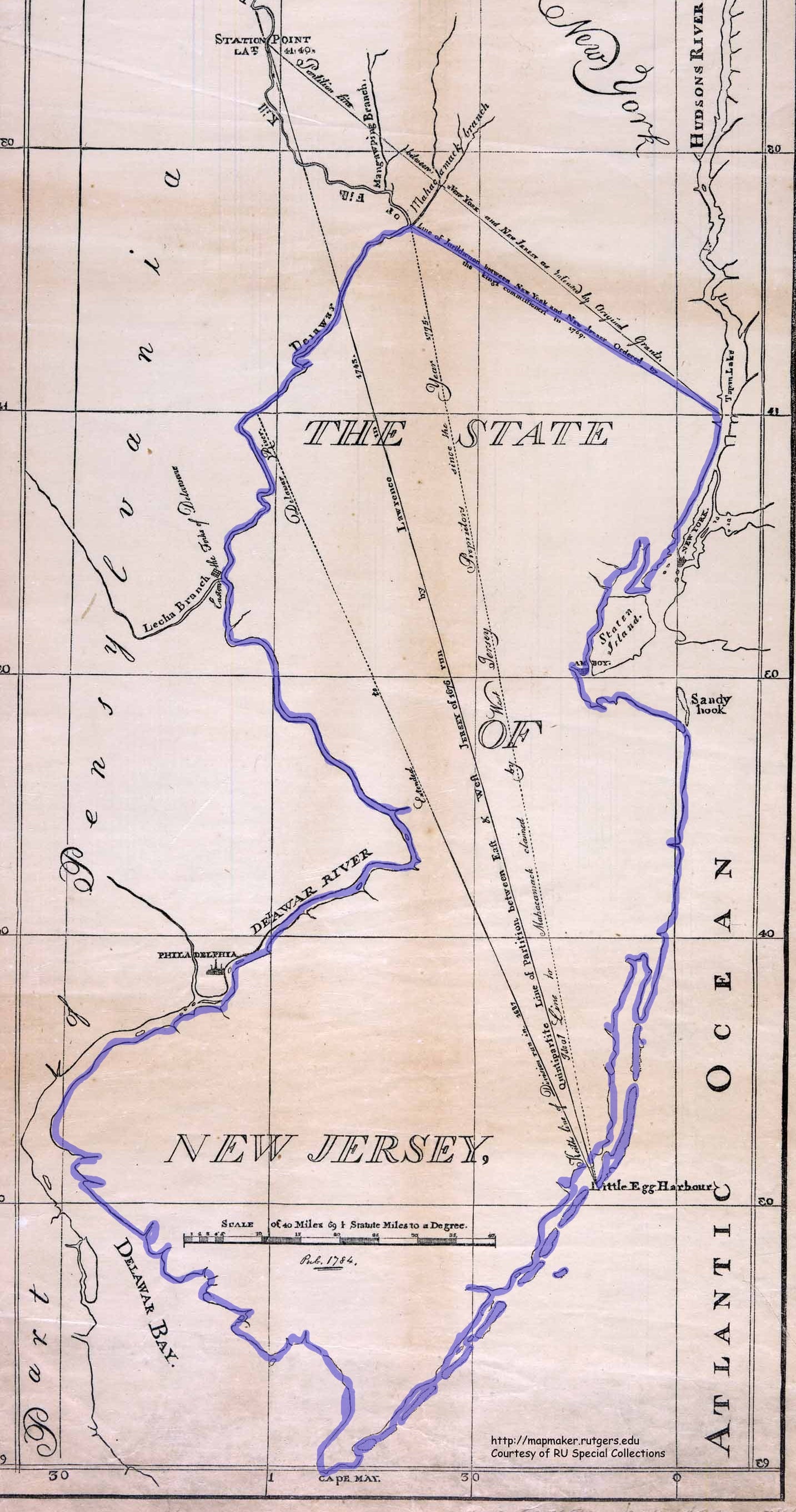
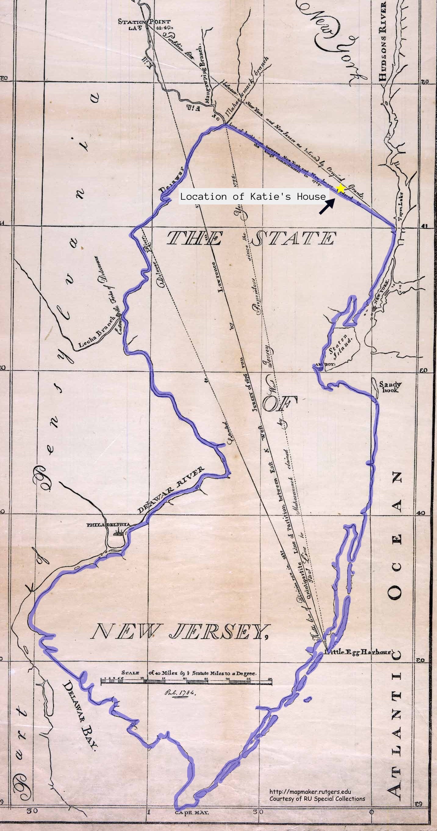
If the New Jersey map of today was the same as the New Jersey map of 1764, the state would look something like this:
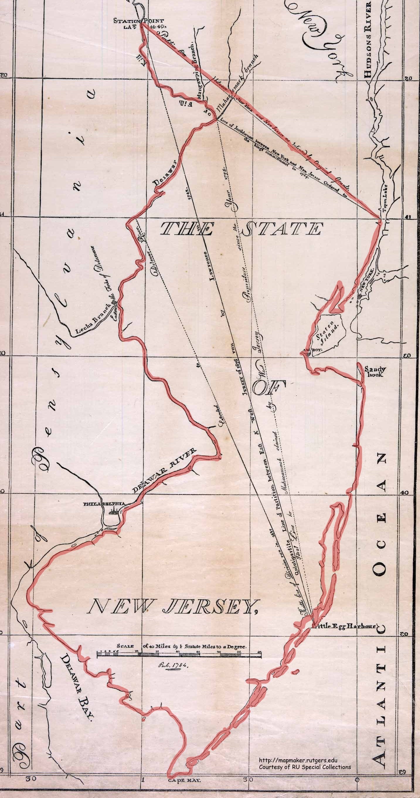
In the original charter of 1664, the Duke of York intended to create a northern boundary line based on geography. Under these circumstances, New Jersey northern boarder would run from:
…” the assumed northernmost branch of the said Bay or River of Delaware, which is forty-one Degrees and forty minutes of Latitude and crosseth over thence in a straight line to Hudson’s River in forty-one Degrees of Latitude.”
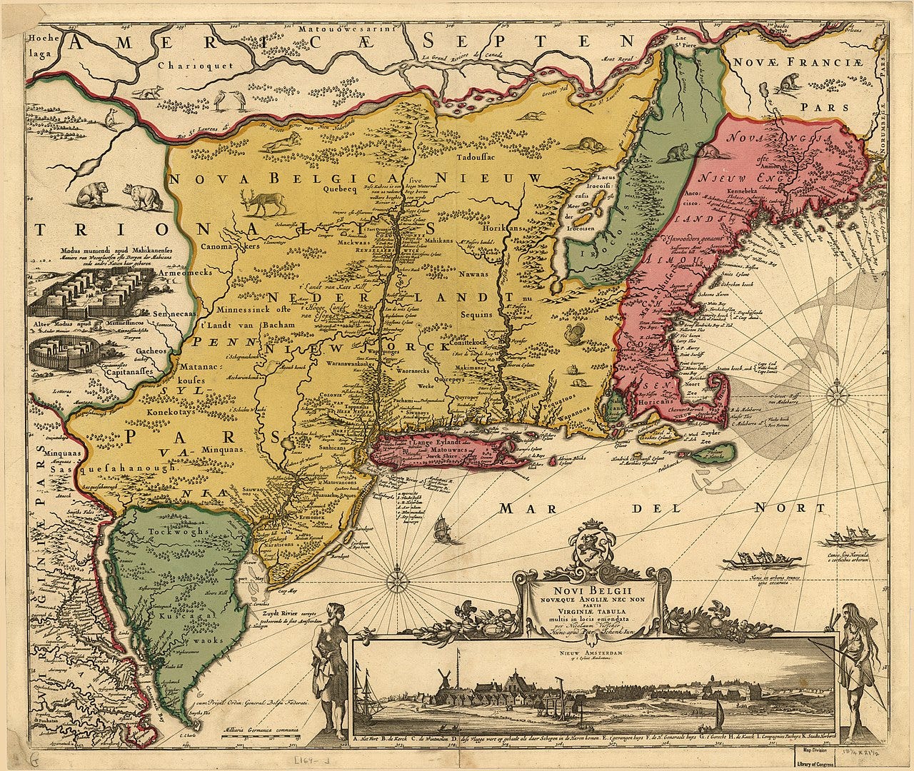
However, the Duke based his charter on an inaccurate map created by Dutch cartographer Nicolas Johannis Visser in 1654. The Jansson-Visscher map, as it would later become known, established the northernmost branch of the Delaware River at latitude 41° 40’ N (in Sullivan County, NY). Unfortunately, no branch of the Delaware existed at this exact latitude.
Luckily, in 1664, the exact boundary of where one piece of gigantic wilderness stopped and another one began was not incredibly important. So this boundary was not even remotely formalized or agreed upon between the two states. This may have been because the boundary negotiation was actually happening between three regions: New York, West Jersey and East Jersey (another boundary dispute existed between East and West Jersey, but that’s a story for another time).
It was not until 1686 that an agreement was reached between the Governors of New York and New Jersey to survey a line. On September 1, 1686, George Keith, of East New Jersey, Andrew Robinson, of West New Jersey, and Philip Wells of New York, met along the Delaware River. The Council of New York instructed Wells:
“You are to carefully and with great exactness run the Line between this province and that of East Jersey, beginning in the latitude of forty-one degrees and forty minutes upon the Delaware River.”
It seems as if Wells and Co. drafted a survey with the line, but being aware of the stakes at play, refused to put it to print until it was approved by all parties. As such, a line was never created.
As years passed between stilted attempts to firm up the legal border between New York and New Jersey, neither government did anything to discourage settlements along the boundary, making the confusion over the border dispute even more complicated.
In 1717, New York Governor Robert Hunter decided the time had come to reduce tensions and resolve the dispute over the border. He inserted a provision in New York's 1717 debt bill providing authorization for an official survey of the line, as long as an agreement could be reached with New Jersey over the line's exact location.

In April and May of 1717 Governor Hunter took his message to the New Jersey legislature. He told them of his efforts to end the dispute and of the debt bill's passage by the New York Assembly. Two years later, the New Jersey Legislature passed "An Act for Running and Ascertaining the Division Line betwixt this Province and the Province of New York." An official boundary line would finally be drawn.
On June 22, 1719, representatives from both colonies met at a location on the Delaware River to determine the true north point of the Duke of York's deed of 1664. The expedition was met with resistance from the very start, both from within the survey party (members quarreled with one another) and without (settlers of New York who fought the idea of living in New Jersey). But on July 25th they arrived at a final agreement, which came to be known as the "Tri Partite Deed". This agreement placed the northern station point just upstream of a native american village named Casheightouch, today known as Cochecton, New York, at 41° 40′.
But that’s not the end of the story. Before the final survey of the line could be completed one of the New York comission reported feeling ill. The expedition was suspended until September, and many of New York's commissioners decamped to New York City, where the commissioners spoke to several of their friends who had property along the border. These wealthy landowners used their influence to campaign aggressively against the Tri-Partate Deed, and the hard fought for compromise was skuttled.
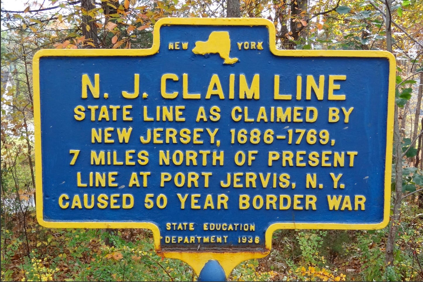
In 1720, with the Tri-Partate Deed officially dead, open warfare broke out in settlements along the disputed border. Local skirmishes continued for several decades. By 1760, the two provinces agreed that the only path forward was to let King George III appoint a commission to study and recommend a solution. On October 7, 1769, the Royal Commission decided the boundary lines to be 41° 21′ on the Delaware River and 41° on the Hudson.
In an 1833 act of Congress, representatives from New York and New Jersey entered into an agreement that respected each state’s territorial limits and jurisdictions, and solidified the boundary lines observed today.
Final Thoughts:
So exactly how close was I to growing up and living in New Jersey, instead of New York state? Well, about 250 years and a just few minutes of latitude.
Links:
https://storymaps.arcgis.com/stories/eb39a581acec4ed68c4bded2fe05aa09
https://nj.gov/dep/njgs/enviroed/oldpubs/bulletin67.pdf
https://jerseyhistory.org/guide-to-the-records-of-the-new-york-and-new-jersey-boundary-dispute
https://static-prod.lib.princeton.edu/njmaps/background/state_maps.html
https://www.nj.gov/state/archives/pdf/proprietors.pdf
Thanks. Very interesting and informative.